Landscape measuring software for property measurement and lawn measuring that prices the job
LandscapeEstimating is landscape measuring software for US contractors. Search any US address, trace turf, beds, sod, hardscape and edging on satellite imagery, and the square feet, linear feet and counts appear as you draw. Each traced layer is tied to a priced service in your cost library, so the measurement turns straight into an estimate and a proposal the client signs online. Plans start at $129 a month per company, with 60 satellite measurements included.
The problem
Why a measurement on its own still loses bids.
Why property measurement software alone doesn't win the job
Most landscape companies already measure somehow. A wheel and a notepad, a laser, a free map in the browser, an app on the phone. The number is rarely the problem. What happens after it is.
The square footage gets written on a sticky note, typed into a spreadsheet at night, multiplied by a rate somebody set three seasons ago and pasted into a quote template. Every handoff is a chance to drop a bed, forget the edging or price mulch at the wrong depth. By the time the quote goes out, a competitor who measured from the office that afternoon has already sent theirs.
- Drive-outs to measure jobs you may not win, two or three a day in spring
- Measurements and prices living in different files, so nobody can check the math
- Mulch, sod and base material ordered from a guess, then a second trip to the yard
- Estimators pricing the same lawn differently because each one measures differently
How it works
From a US address to a signed proposal.
How landscape measuring software works in LandscapeEstimating
The measuring and the pricing happen on the same map, so there's nothing to retype.
You can trace a sample property or one US address of your own before you create an account.
- Search the property address and the satellite map opens on the lot
- Pick a layer (turf, beds, sod, pavers, other hardscape) and click around the edge; the area shows the moment you close the shape
- Draw lines for bed edging, curbs and fence runs in linear feet, and click once per tree, shrub or irrigation head to count them
- Cut holes for patios and driveways inside a lawn, so the turf number matches what the mower covers
- Each layer prices from your cost library: material, waste, production rate, labor rate, overhead and margin
- Send a branded proposal with good, better and best options; the client signs online
Measurements
Areas, lengths and counts by layer.
Lawn measuring software features for landscape contractors
| What you trace | Measured in | What it prices |
|---|---|---|
| Turf | Square feet | Mowing per visit, fertilization, aeration, overseeding |
| Mulch and planting beds | Square feet, then cubic yards at your depth | Mulch, bed cleanup, weeding, delivery |
| Sod | Square feet | Sod, soil prep, starter fertilizer, labor at your rate |
| Pavers and hardscape | Square feet | Pavers, base gravel, bedding sand, install hours |
| Edging, curbs, borders | Linear feet | Spade edging, steel or stone edging, labor per foot |
| Trees, shrubs, irrigation heads | Count | Pruning, plantings, head checks and repairs |
Area is calculated geodesically, so a 3-acre commercial site stays as accurate as a quarter-acre front yard. The traced map stays attached to the estimate, which means a client who asks "why 14 yards of mulch" gets an answer you can show them.
Who it's for
Contractors who quote more than they can drive to.
Who buys landscape measuring software
- Lawn care and maintenance companies quoting 20 or more new properties a month, where every skipped drive-out is an hour back
- Design-build and enhancement contractors whose bids depend on bed area, edging length and hardscape square footage; our landscape takeoff software page goes deeper on install takeoffs
- Commercial contractors measuring HOA common areas, office parks and retail sites in sections and rebidding them each year from the saved map
- Owners who want every estimator to measure and price the same way, with one cost library and margin checks
If you mostly need a quick square footage for one yard, the yard measurement tool shows the live tracing on its own.
Compare
How contractors measure properties today.
Property measurement software options compared
There are four common ways to measure a landscape property. Each has a place. The table sums up what each approach or vendor says about its own product; check current plans with each vendor, since they change.
| Option | How it measures | Price published | Prices the job | Best for |
|---|---|---|---|---|
| Measuring wheel or laser on site | You walk the property | Hardware cost | No | Small jobs close to the shop |
| Moasure | Motion-based device on site | Device price | No | Hardscape and odd shapes where inches matter |
| SiteRecon | AI property maps from aerial imagery, credits per takeoff | Yes, plan tiers | Takeoff output, pricing elsewhere | Larger maintenance portfolios |
| PropertyIntel (Aspire) | Aerial and PDF takeoffs | No, quote | Inside Aspire | Multi-branch companies on Aspire |
| Beam AI (Attentive.ai) | Done-for-you takeoffs, 6 to 48 hours | No, annual credits | No | Commercial bids with time to wait |
| PlanSwift, STACK | Blueprint and PDF takeoff | Varies | Takeoff and bid | Plan-based commercial bids |
| LandscapeEstimating | You trace on satellite, results live | Yes, from $129 a month | Yes, from your own rates, with e-sign | Contractors who want the measurement and the price in one step |
Where others win: SiteRecon and Beam AI do the tracing for you, which matters on very large sites, and blueprint tools are the right call when the job only exists on paper. A wheel or a Moasure device is still the most exact way to confirm a retaining wall. Where we win: the measurement is priced the moment you draw it, with your production rates and margin, at a published price per company. More detail is in our SiteRecon alternative and Attentive AI alternative pages.
FAQ
- How accurate is satellite property measurement for landscaping?
For turf, mulch beds and edging on open lots, a careful satellite trace is close enough to price, and the waste factor on each material covers normal variation. Two things reduce accuracy: tree canopy that hides a bed edge, and imagery that predates a new patio or a removed bed. For pavers, walls and anything priced by the inch, confirm the critical dimensions on site before the final number. The crew lead sees the traced map on the job, so a mismatch shows up before the material is ordered.
Plans
Measurements included every month.
Landscape measuring software pricing
Every plan is priced per company, with estimator seats and satellite measurements included. Measurements renew each billing month.
| Plan | Monthly | Billed yearly | Estimator seats | Satellite measurements a month |
|---|---|---|---|---|
| Crew | $129 | $64 a month | 2 | 60 |
| Company | $299 | $149 a month | 6 | 250 |
| Operations | $649 | $324 a month | 15 | 800 |
| Enterprise | $1,298 | $649 a month | 40 | 2,000 |
Company adds assemblies, waste factors, good, better and best options, job costing and the QuickBooks Online export. Full details are on the pricing page.
FAQ
- What is the best software to measure landscape areas?
The best choice depends on what happens after the measurement. If you need a number only, a free map or a wheel works. If you quote often, landscape measuring software that prices the trace from your own rates, such as LandscapeEstimating, saves the retyping step and keeps every estimator consistent.
- How do landscapers measure a property without visiting it?
They trace it on satellite imagery. You search the address, outline the lawn, beds and hardscape, and the software returns square feet, linear feet and counts. Most maintenance and enhancement work can be priced this way, and you confirm hardscape and areas under heavy tree cover on site.
- Is there an app to measure a yard for landscaping?
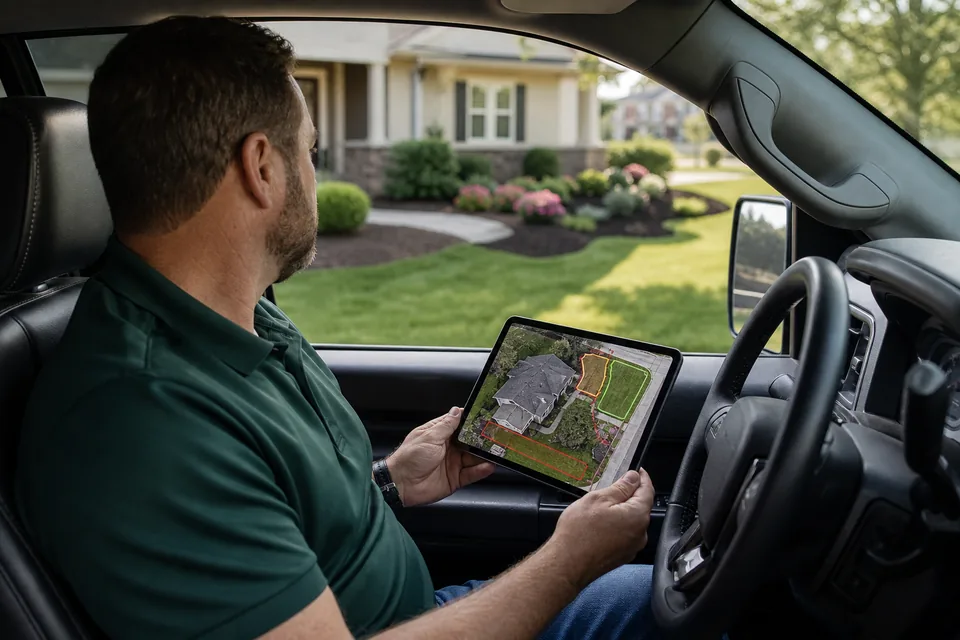
Yes. LandscapeEstimating runs in the browser on a phone, tablet or computer, so you can trace a yard on satellite imagery from the truck and send the proposal before you leave. Our lawn care estimate app page covers quoting on site.
- How much does landscape measuring software cost?
LandscapeEstimating starts at $129 a month per company with 2 estimator seats and 60 satellite measurements, or $64 a month billed yearly. Company is $299 a month with 250 measurements. Some measuring tools charge per takeoff credit or only quote prices after a demo.
- Can property measurement software measure commercial sites?
Yes. Trace large sites in sections, one layer at a time, and save the map with the estimate. When the contract comes up for rebid next year, you open the same map, adjust what changed and reprice from your current cost library.
- Does lawn measuring software calculate mulch and sod?
LandscapeEstimating does. Bed area converts to cubic yards at the depth you set, with your waste factor and a delivery charge, and sod area adds soil prep and starter fertilizer. Change the outline and the quantities, labor and price all update together.
Get started
Measure the next property from your desk and send the price today
Trace a real US address, watch the square footage and the price build together, and see the proposal your client would get. When it matches how you price, create your account.